Explore Gombe’s Tourist Attractions
Discover natural landscapes, cultural sites and places of historical interest across Gombe State. Select an attraction to explore its story, photographs and visitor information.
-
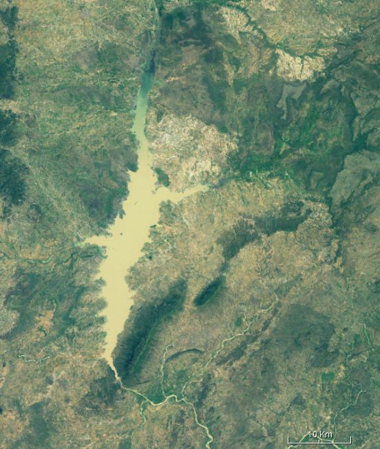
Dadin Kowa Dam
About this attraction Dadin Kowa Dam is a major multipurpose water infrastructure project on the Gongola River in Yamaltu/Deba Local Government Area. The Upper Benue River Basin Development Authority places the dam about 5 km north of Dadin-Kowa village and about 37 km from Gombe town along the Gombe–Biu Road. The project was initially identified…
-
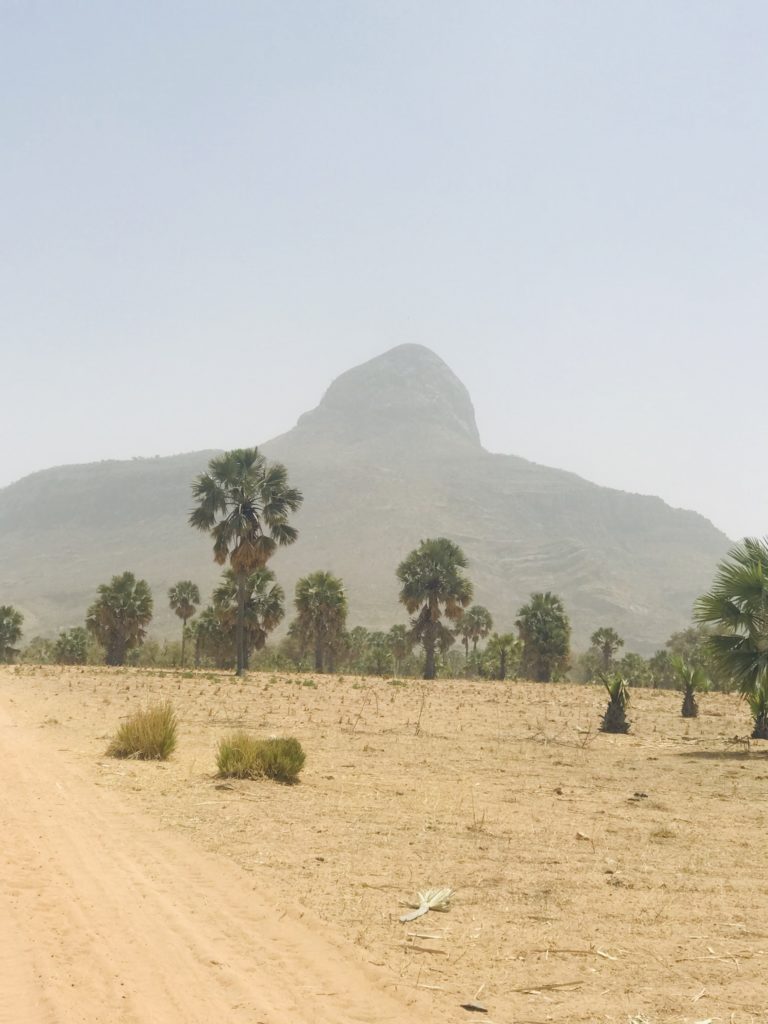
Kilang Hill
About this attraction Kilang Hill is described in Gombe State’s education-sector planning document as a hill with a distinctive pentagonal shape and as a prominent volcanic dyke in the North-East sub-region. Its unusual geological form makes it one of the state’s notable natural-landscape attractions. Visitor Information Visitor information: The reviewed state source describes the hill’s…
-
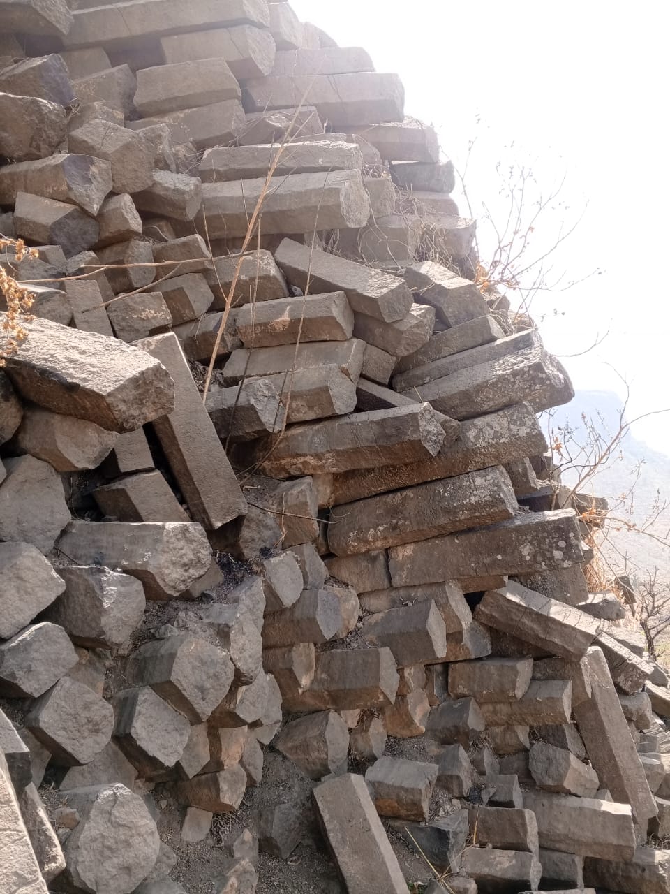
Cham Valley
Explore Cham Valley in Balanga Local Government Area of Gombe State, with its distinctive rocky landscape and visitor access route.
-
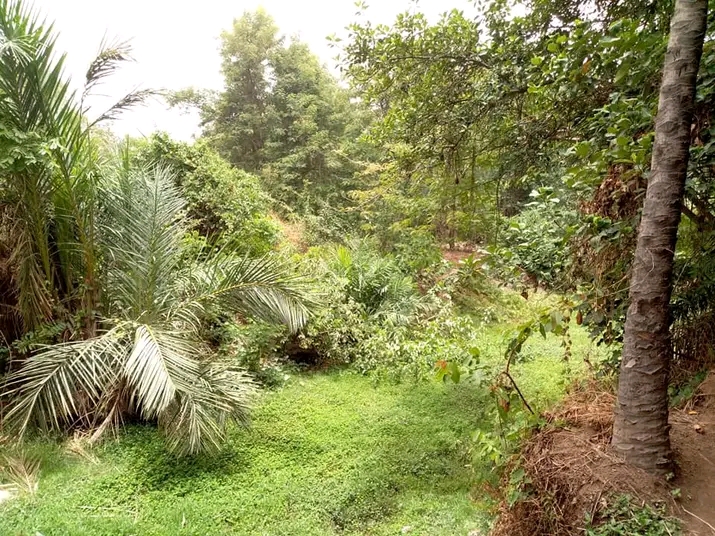
Kanawa Plantation
About this attraction Kanawa Forest is identified in Gombe State planning material among the state’s natural and tourism assets. The area is associated with woodland scenery, vegetation and the natural landscape of Gombe. The site’s value for visitors is primarily connected with its environment and the opportunity to experience one of the state’s forested landscapes.…
-
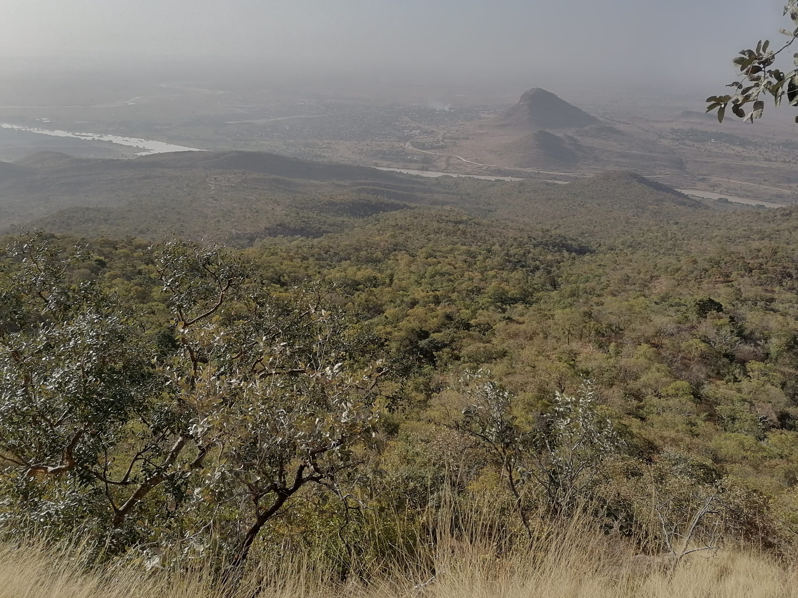
Bima Hills
About this attraction Bima Hill is one of the natural attractions identified in Gombe State’s official education-sector planning material. The same source records a number of local traditions and mysteries associated with the mountain, particularly stories connected with the emergence of the Mahdi. These accounts are presented here as local tradition rather than as independently…
-
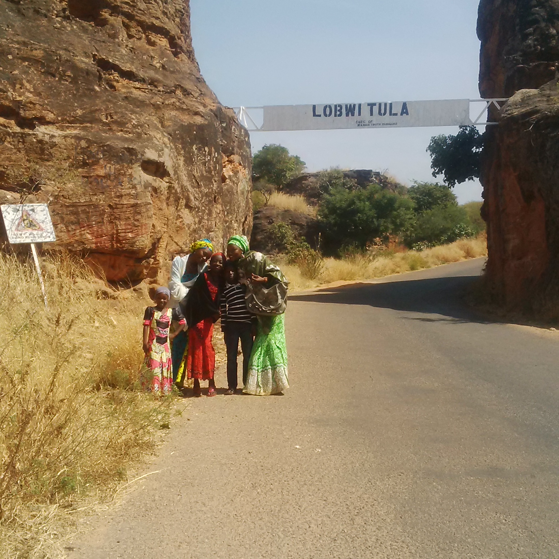
Tula Falls & Plateau
About this attraction Tula Plateau is identified by the Gombe State education-sector document as a naturally scenic landscape with deep valleys, comparatively temperate weather and war caves. These features give the area both landscape and historical interest. The Tula area is part of Gombe’s southern highland zone, which the state government also describes as an…
-
Tomb of Baba Yero
About this attraction The Tomb of Buba Yero is identified in Gombe State’s education-sector planning document as the burial place of Buba Yero, described there as the first Emir of Gombe. The tomb is located at Gombe Abba, near Dukku. It is therefore both a historical site and a place connected with the traditional history…
-
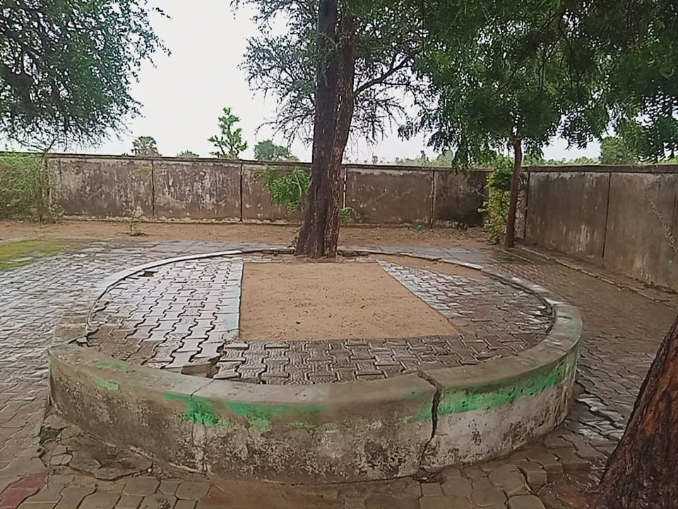
Sultan Attahiru’s Grave
Official tourism information for this attraction will be published here as content is supplied and approved by the Tourism Board. About This Attraction This section will provide the approved history, significance and description of Sultan Attahiru’s Grave. Visitor Information Visitor guidance, access information, opening information where applicable, and other useful details will be added here.…
Gombe State Tourism Resource Directory
Browse the tourism resources recorded in the supplied tourism inventory, organised by Local Government Area and tourism type. GPS coordinates are shown where provided in the source document.
Chiroma Bagauda Forest
Location: Adjacent to ADP Quarters, Kumo
10.0365, 11.2345
View location on map ↗Dutsin Amina Kumo
Location: Kumo Hospital Road
10.0500, 11.1900
View location on map ↗Boho Wrestling Area
Location: Boho Beach Road
10.0715, 11.2890
View location on map ↗Kembu Stream
Location: Kembu, Kumo
10.0234, 11.3145
View location on map ↗Kumo Dam
Location: Tike Road, Kumo
10.0156, 11.2534
View location on map ↗Layinot Forest
Location: Kumo
10.0845, 11.3256
View location on map ↗Binga Hills
Location: Yelwa, Pindiga
10.2350, 11.1456
View location on map ↗Akko Dam
Location: Akko
10.0156, 11.2456
View location on map ↗Kala Gambo Hills
Location: Kalshingi
10.2867, 11.1234
View location on map ↗Jukun Old Settlement
Location: Pindiga
10.1823, 11.2567
View location on map ↗Old Amada Tourist Centre
Location: Amada
10.0523, 11.3812
View location on map ↗Balanga Dam Site
Location: Balanga Village
9.9723, 11.6823
View location on map ↗Mgua Tourist Park
Location: Gelengu
9.8956, 11.7345
View location on map ↗Dadiya Hill
Location: Dadiya
9.8234, 11.6234
View location on map ↗Dele Hill
Location: Dadiya
9.8156, 11.6345
View location on map ↗Quarry
Location: Gelengu
9.9023, 11.7456
View location on map ↗Swarandi Hill
Location: Lafiya
9.9456, 11.5234
View location on map ↗Zwale Hill
Location: Lunguda
9.8234, 11.7456
View location on map ↗Cham Valley
Location: Bambam
9.8567, 11.6789
View location on map ↗Kumana Hills
Location: Tangalang Kufai
9.9234, 11.2345
View location on map ↗Dutsin Mamaki
Location: Tangalang Kufai
9.9123, 11.3234
View location on map ↗Pandi Tal
Location: Tal
9.8456, 11.4123
View location on map ↗Pandi Bore
Location: Baganje
10.0289, 11.2123
View location on map ↗Itacen Daya Zama Duste
Location: Baganje
9.9623, 11.2723
View location on map ↗Bore Hill
Location: Tal
10.0123, 11.2023
View location on map ↗Tangalang Old Settlement
Location: Kufai
9.9034, 11.3123
View location on map ↗Pissi Tangale Festival
Location: Billiri
9.8912, 11.2023
View location on map ↗Bubayero Tomb
Location: Gombe-Abba
10.8267, 10.7123
View location on map ↗Buba yero Mosque
Location: Gombe Abba
10.8256, 10.7089
View location on map ↗Sultan Attahiru Tomb / associated historical area
Location: Bormi/Borni
10.8634, 11.4234
View location on map ↗Gombe Emir's Palace
Location: Gombe town
10.2908, 11.1689
View location on map ↗Gombe Old Garage
Location: Gombe town
10.2819, 11.1678
View location on map ↗Famous Tudun Hatsi
Location: Gombe town
10.2895, 11.1705
View location on map ↗Kilang Hill
Location: Popandi
9.8765, 11.3256
View location on map ↗Tula Caves
Location: Tula
9.8489, 11.4723
View location on map ↗Tula Spring Water
Location: Tula
9.8511, 11.4689
View location on map ↗Lakwaime Spring Water
Location: Kaltungo
9.9123, 11.3423
View location on map ↗Tula Pass Plateau
Location: Tula
9.8323, 11.4289
View location on map ↗Kaltungo Carnival
Location: Kaltungo
9.8195, 11.3112
View location on map ↗Gamji Shamshamo
Location: Bojude
10.5123, 11.2345
View location on map ↗Grains Silos
Location: Kwami
10.5234, 11.2612
View location on map ↗Sand Dunes
Location: Jar-Kwami
10.5234, 11.0234
View location on map ↗Dadina Labbo Fishing Village
Location: Malleri
10.4234, 11.3423
View location on map ↗Gidan Hakimi of Kwami — ancient trees, buildings and artifacts
Location: Kwami
10.4823, 11.1523
View location on map ↗Nafada River Site
Location: Nafada
11.0892, 11.3434
View location on map ↗Biri Hill & Valley
Location: Biri
10.6234, 11.1234
View location on map ↗Gypsum Beacon
Location: Nafada
11.1234, 11.4234
View location on map ↗Ambulok Spring Water
Location: Latur
11.0234, 11.2834
View location on map ↗Lakomji Spring Water
Location: Labarya
10.1234, 11.2634
View location on map ↗Paleng Hill
Location: Filiya
10.0234, 11.3234
View location on map ↗Bangunji Hill
Location: Bangunji
10.1434, 11.3434
View location on map ↗Dadin Kowa Dam Site
Location: Dadin Kowa
10.3123, 11.4234
View location on map ↗Kanawa Plantation
Location: Kanawa
10.3423, 11.3623
View location on map ↗Bima Hill
Location: Hinna
10.2823, 11.5123
View location on map ↗Irrigation Pilot Farm
Location: Dadin Kowa
10.3223, 11.4323
View location on map ↗Liji Hill
Location: Liji
10.2523, 11.1823
View location on map ↗Wade Hill
Location: Wade
10.2123, 11.4723
View location on map ↗Fish Hatchery
Location: Dadin Kowa
10.3189, 11.4256
View location on map ↗Fish Pond
Location: Dadin Kowa
10.3167, 11.4223
View location on map ↗Water Treatment Plant
Location: Deba
10.2123, 11.3823
View location on map ↗Baure Orchard
Location: Deba
10.1923, 11.3923
View location on map ↗Source: supplied Gombe tourism resource document. Coordinates and classifications are presented as provided in the source.